Mariners Island Real Estate | San Mateo, CAListings

Mariners Island Real Estate | San Mateo, CA

Mariners Island is a premium residential enclave in San Mateo’s eastern section — a bayfront community on a peninsula of land extending into San Francisco Bay, offering the water-surrounded residential environment that the ‘Island’ designation suggests. Properties in Mariners Island benefit from bay views on multiple sides, immediate access to the San Francisco Bay Trail, and the semi-private character that the community’s distinctive geographic isolation from the surrounding mainland creates. For buyers who specifically want a bay-adjacent residential experience on the Peninsula, Mariners Island provides a uniquely water-surrounded setting within San Mateo’s residential market.

Mariners Island Real Estate | San Mateo, CA

Mariners Island is a bayfront peninsular residential neighborhood in San Mateo, on the man-made Mariner’s Island peninsula in San Francisco Bay. Mariner’s Island is San Mateo’s most distinctive residential address: a man-made peninsula into San Francisco Bay with waterfront properties on three sides and the bay lifestyle throughout. The community provides direct access to San Mateo’s amenities, schools, and employment corridors while maintaining its own residential identity.

Neighborhood Character

Mariners Island reflects the residential pattern of San Mateo’s bayfront peninsular residential areas, with the property mix, lot sizes, and streetscape that the neighborhood’s position within the city defines. Buyers drawn to this area prioritize the combination of location, school access, and price point that Mariners Island delivers within the San Mateo market.

Market Position

$1.6M–$2.6M: Entry Mariners Island. Properties at the more accessible end of this neighborhood’s range.

$2.6M–$5M+: The primary Mariners Island range. Well-positioned properties delivering the neighborhood’s full value.

Current Mariners Island Listings

Connect with TKG about Mariners Island real estate in San Mateo.

Search all homes for sale in San Mateo real estate and explore the broader San Mateo County market.

[showcaseidx_hotsheet name=”Los Angeles”]

Mariners Island Real Estate | San Mateo, CA in San Mateo

Community

What should I know about Mariners Island?

Mariners Island’s geographic position — a peninsula of land extending into San Francisco Bay from San Mateo’s eastern shoreline — creates the semi-island residential environment that gives the community its name. The water presence on multiple sides produces a specific lifestyle: bay views from multiple orientations, immediate San Francisco Bay Trail access for walking, running, and cycling along the water’s edge, and the visual and acoustic separation from the mainland that a bay-surrounded position provides. The community’s distinct geography makes it one of the most specifically identifiable residential addresses in San Mateo, with the bayfront character immediately recognizable as a defining attribute rather than merely a locational description.

The residential stock in Mariners Island includes single-family homes, condominiums, and townhome communities within the enclave, with the premium water-facing positions commanding the highest prices and the interior locations providing somewhat more accessible entry points into the community. Waterfront properties with direct bay frontage or unobstructed bay views represent the most sought-after addresses within Mariners Island, and the community’s limited inventory means that these properties compete intensively among the buyer pool that specifically seeks the waterfront residential experience on the Peninsula.

The San Francisco Bay Trail runs along the bay edge adjacent to Mariners Island, providing a multi-use trail for walking, running, and cycling with open water views that access the full breadth of the bay’s visual environment. For active residents who use the trail regularly, the ability to walk or run along the bay from their front door without loading a bicycle or driving to a trailhead is a daily lifestyle feature that distinguishes Mariners Island from most Peninsula residential alternatives regardless of price point. The East Bay hills and bridges visible from the trail provide the kind of panoramic natural backdrop that most residential environments cannot access from this distance.

The school district serving Mariners Island is the San Mateo-Foster City Elementary School District for K-8, with the specific campus assignment depending on current enrollment boundaries. For high school, students attend one of the San Mateo Union High School District’s San Mateo campuses. The geographic isolation of Mariners Island’s peninsula position means that reaching school by walking is generally impractical, and most families drive to school campuses regardless of school assignment. The bay trail, however, provides a notable cycling route for older students whose schools are accessible by bike along the trail corridor.

Mariners Island: Enclave Living on San Mateo’s Bay Peninsula

Mariners Island is a residential enclave on the peninsula that extends into the San Francisco Bay from eastern San Mateo — the “island” character reflects the semi-surrounded-by-water character of the residential community, where the tidal channels and the bay waters create the genuine waterfront setting on multiple sides. The community’s peninsula position creates the panoramic bay views (across both the San Mateo Bridge and toward the East Bay hills), the marina access, and the waterfront lifestyle that the Mariners Island address delivers as the defining residential premium. The residential community’s quality standards, the bay trail access, and the marina infrastructure create the complete waterfront residential package that distinguishes Mariners Island as one of San Mateo County’s most distinctive waterfront residential addresses within the San Mateo market.

Area Details

What schools and Caltrain stations serve Mariners Island?

San Mateo’s three Caltrain stations — San Mateo, Hayward Park, and Hillsdale — provide the most comprehensive rail transit coverage of any city in San Mateo County, reflecting the city’s scale and the geographic distribution of its residential neighborhoods across a north-south corridor that a single station could not efficiently serve. The San Mateo station is adjacent to the downtown district and serves the city’s northern and central residential areas. Hayward Park station serves the mid-city residential sections. Hillsdale station, near the Hillsdale Shopping Center and Caltrain’s southernmost San Mateo stop, serves the southern residential areas. For buyers who commute by Caltrain, the choice of which San Mateo neighborhood to target should be informed by which station provides the most convenient access from a prospective address.

The San Mateo-Foster City Elementary School District is San Mateo’s K-8 school authority, operating multiple elementary and middle school campuses across the city. The district serves a broad demographic range and maintains strong academic programming at its top-performing schools, though academic outcomes vary more across campuses than in smaller, more homogeneous districts like the San Carlos or Burlingame elementary districts. The specific school assignment for any San Mateo address depends on current enrollment boundaries; buyers with school-age children should verify assignments with the district office and review the academic performance data for the specific campus that would serve their prospective address. For high school, San Mateo students attend San Mateo High School, Hillsdale High School, or Aragon High School based on address location in the Sequoia Union High School District.

The Japanese Tea Garden in San Mateo’s Central Park is the city’s most distinctive cultural amenity — a traditional Japanese garden with a tea house, koi pond, stone lanterns, and seasonal blooms that provides a genuine cultural and recreational oasis within the urban residential environment. Central Park itself, with athletic fields, a public swimming pool, and extensive picnic and open space areas, is the city’s primary recreational hub and a daily-use facility for residents of the surrounding neighborhoods. The Hillsdale Shopping Center provides major retail anchor access that most Peninsula cities of San Mateo’s size maintain without equivalent commercial infrastructure. Highway 101 and 92 provide major freeway access, with the San Mateo-Hayward Bridge (Route 92) providing a cross-bay connection to the East Bay that is specific to San Mateo’s geographic position.

Market Trends

How is the San Mateo Real Estate real estate market?

San Mateo is one of San Mateo County’s most diverse and most accessible mid-tier residential markets — a city of approximately 105,000 residents where the 2026 median home price ranges from approximately $1.6 to $1.9 million for single-family homes and where the range of residential product types, from the waterway-adjacent Shoreview and Marina Lagoon neighborhoods to the hillside estates of Baywood Park and the Western Hills, creates buying opportunities across a broad buyer profile. San Mateo’s scale gives it the commercial and institutional infrastructure of a genuinely urban city — three Caltrain stations, a robust downtown district, and a diverse school system — while maintaining the residential character and neighborhood scale that mid-sized Peninsula cities typically sustain better than larger Bay Area cities.

The city’s residential sub-markets reflect significant geographic variation. The western hillside neighborhoods — Baywood Park, Baywood Knolls, Highlands, Highlander, Western Hills, Westwood Knolls, Sugarloaf — occupy elevated terrain with bay and valley views, larger lots, and the premium pricing that elevated residential positioning commands throughout San Mateo County. Baywood Park, the city’s most prestigious hillside neighborhood, trades at medians well above the city average, competing with neighboring Hillsborough and Burlingame on residential quality while remaining within San Mateo’s overall market context. The flatland central and eastern sections — Downtown San Mateo, Hayward Park, Beresford Park, Fiesta Gardens, North Central — offer more accessible pricing with Caltrain walkability and downtown commercial access. The bay-adjacent eastern sections — Shoreview, South Shoreview, North Shoreview, Marina Lagoon, Mariners Island, Tidelands, Westshore — provide bay views and waterway access at pricing that reflects the eastern, bay-adjacent position.

The school district serving San Mateo’s K-8 students is the San Mateo-Foster City Elementary School District — a large multi-school district that operates across San Mateo and Foster City, maintaining strong academic programming while serving a more demographically diverse student population than the smaller, wealthier districts in Hillsborough, Burlingame, and San Carlos. For high school, San Mateo students attend San Mateo High School, Hillsdale High School, or Aragon High School in the San Mateo Union High School District. The three high schools serve different geographic sections of the city, and the specific campus assignment depends on address location.

Downtown San Mateo’s 3rd and 4th Avenue corridor is one of San Mateo County’s most vibrant commercial districts — a dining, retail, and entertainment environment that supports multiple Caltrain station access (the San Mateo station is immediately adjacent to downtown) and draws visitors from across the mid-Peninsula. The Japanese Tea Garden in Central Park, the Hillsdale Shopping Center, and the Filipino Cultural Arts Center are among the city’s distinctive civic and cultural institutions that give San Mateo a cultural depth that smaller Peninsula cities cannot sustain at the same scale.

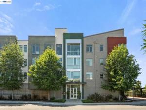
How is the San Mateo Real Estate real estate market?

San Mateo is San Mateo County’s largest and most diverse city — the city of approximately 105,000 residents provides the full spectrum of Peninsula residential options, from the entry-level condominiums near the El Camino Real corridor to the estate-scale homes in the Beresford, Laurelwood, and hillside neighborhoods. The downtown Third Avenue commercial district (with its independent restaurants, wine bars, boutiques, and the active street life that makes Third Avenue one of the most consistently praised downtown districts in the Bay Area), the Caltrain Baby Bullet station, and the central mid-Peninsula location create the urban residential lifestyle that the San Mateo buyer values as the complete Peninsula living infrastructure. Median home prices in San Mateo range from approximately $1.3M for entry-level single-family homes to $3M+ for the larger properties in the premium neighborhoods, positioning San Mateo as a broadly accessible mid-Peninsula family market with a full range of residential options at every price tier.

San Mateo’s residential market is sustained by the combination of the San Mateo-Foster City Elementary School District (one of the stronger elementary districts in San Mateo County), the Caltrain Baby Bullet access (express service to San Francisco and Silicon Valley), the city’s diverse employment base, and the city’s well-developed community infrastructure. The city’s central position on the Peninsula — equidistant between San Francisco and Silicon Valley’s major employment centers — creates the commuter residential appeal that sustains broad residential demand across all price tiers. TKG’s Peninsula expertise includes the full San Mateo residential spectrum.

FAQs

What makes Mariners Island unique in San Mateo?

Mariners Island’s peninsula position extending into San Francisco Bay creates a water-surrounded residential environment unlike any other location in San Mateo’s residential geography. Bay views from multiple orientations, immediate San Francisco Bay Trail access, and the geographic seclusion of the peninsula’s limited access roads produce a residential character that is specific to this location. No other San Mateo neighborhood offers the same combination of water-surrounding, bay trail frontage, and mid-city positioning.

What are the bay views like from Mariners Island?

Mariners Island properties have bay views from multiple orientations given the peninsula’s water-surrounding geography. East-facing views capture the East Bay hills and bridges; north-facing views extend toward San Francisco and the Marin headlands; south-facing views cover the San Mateo-Hayward Bridge and the South Bay. The specific view quality from any individual property depends on orientation, building height, and vegetation or structure interference. Properties with clear water frontage and elevated positions within the community capture the most comprehensive bay panoramas. Views should be verified in person for any specific property under consideration.

Is the Bay Trail accessible from Mariners Island?

Yes. The San Francisco Bay Trail runs along the bay edge adjacent to Mariners Island, accessible on foot from the community. The trail provides a multi-use path for walking, running, and cycling with open water and East Bay views throughout its length in this section. For active residents, the trail access from Mariners Island is a daily lifestyle feature — morning runs along the bay, cycling to Coyote Point or south toward Foster City’s trail system, and wildlife observation of the shorebirds and waterfowl that use the bay edge as habitat throughout the year.

What is the commute from Mariners Island?

The Hayward Park Caltrain station is the closest rail transit option to Mariners Island, accessible by car in approximately 5 to 10 minutes from most community addresses. Highway 101 access via the Hillsdale or 3rd Avenue interchanges provides freeway connectivity for car commuters. The San Mateo-Hayward Bridge (Route 92) is accessible via nearby exits, providing direct East Bay access for buyers whose work destinations are in the Fremont-Union City-Hayward corridor. SFO is approximately 15 to 20 minutes by car.

San Mateo Real Estate FAQs

What neighborhoods in San Mateo are most popular with families? The Beresford, Laurelwood, and Sugarloaf neighborhoods in central and southern San Mateo are consistently among the most popular for families, given the school district attendance boundaries and the established single-family residential character. The Hillsdale neighborhood and the North Shoreview waterfront neighborhood attract buyers at different price points and with different lifestyle priorities.

How are the schools in San Mateo? The San Mateo-Foster City Elementary School District (SMFCSD) serves grades K-8, with multiple elementary schools across the city. High school students attend San Mateo High School or Hillsdale High School (San Mateo Union HSD), both of which offer comprehensive academic and extracurricular programs.

What is the commute like from San Mateo? San Mateo has two Caltrain stations — the main San Mateo station (a Baby Bullet express stop) and the Hayward Park station. The Baby Bullet provides express service to San Francisco in approximately 30-35 minutes and to Palo Alto and San Jose in 15-20 minutes. The 101 Freeway and the 92 corridor (to the East Bay via the San Mateo-Hayward Bridge) provide alternative commute options.

Hey, You ALMOST MISSED IT!

Lucky for you we’re looking out.

Subscribe to this Custom Search to be alerted when new properties hit the market in the area.

Choose the frequency that works for you.

get alerts

[showcaseidx_contact]