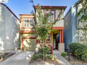
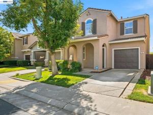
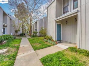
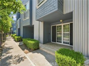
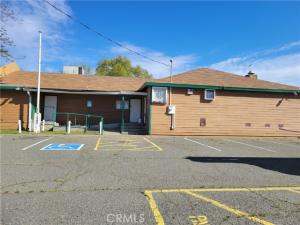
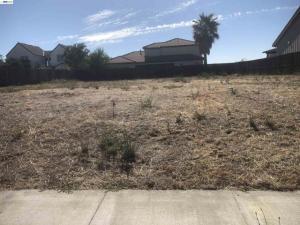
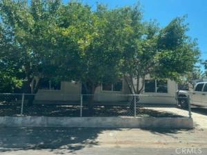
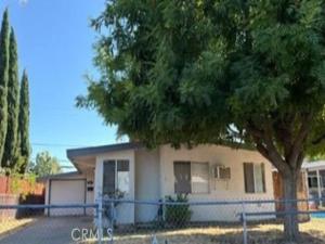
Yolo, CA

Yolo is a very small unincorporated community in the center of Yolo County, situated along County Road 12 in the agricultural plain approximately 10 miles west of Woodland. The community is one of the smallest named places in the county, consisting of a handful of residential properties, a grain raise that serves as the primary commercial marker, and the agricultural landscape that extends in all directions from the community’s minimal physical footprint. Yolo’s interest in the real estate context is primarily as a rural address rather than as a community with civic infrastructure, commercial amenity, or a defined residential character distinct from the surrounding agricultural plain.

The community’s name is shared with the county in which it sits, and the resulting naming redundancy can cause confusion for buyers who are not familiar with the geography. Yolo the community is not the county seat, which is Woodland, and it is not the largest or most prominent community in Yolo County. It is a small agricultural service point that shares its name with the county by virtue of its historical position as one of the early settlements in the county’s agricultural interior.

What is Yolo real estate like?

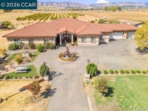
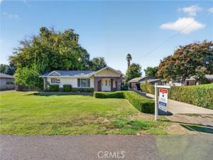
Real estate in the Yolo community area consists almost entirely of agricultural land and rural residential properties on the surrounding farmland. The housing stock is very limited, and the available inventory when it appears is typically older rural homesteads on agricultural parcels rather than conventional residential subdivisions. Prices reflect the agricultural character and the distance from services that define the rural Sacramento Valley interior, making Yolo one of the more affordable rural residential options in the county for buyers who are specifically seeking agricultural land or a rural lifestyle without the premium that the foothill settings, river communities, or university town proximity command in other parts of Yolo County.

The surrounding agricultural landscape is dominated by the same field crop and processing tomato production that characterizes the broader Yolo County valley floor, with irrigation canals and farm roads providing the infrastructure that supports the area’s agricultural economy. Buyers who are seeking this intensely agricultural setting, with farm equipment traffic and harvest activity as part of the daily environment, will find the Yolo area consistent with the Sacramento Valley agricultural lifestyle. Buyers who want rural character without the active farming adjacency should compare the Yolo area to the foothill settings near Winters or the Cache Creek corridor, which offer more natural landscape character with less agricultural production activity in the immediate residential environment.

What are the schools and services like in Yolo?

Students in the Yolo community attend schools in the Yolo Union Elementary School District for grades K-8, with secondary students accessing the Woodland Joint Unified School District high school campuses in Woodland. The small elementary district provides the intimate small-class school environment common to rural California districts, and the bus connection to Woodland for secondary school reflects the standard pattern for rural Yolo County communities that are too small to support their own high school programs. Woodland’s commercial infrastructure serves as the primary service center for Yolo community residents, with the drive to Woodland taking approximately 15 to 20 minutes via the county road network.

Getting Around from Yolo

Yolo’s central Yolo County position places it approximately 10 miles west of Woodland and approximately 15 miles northwest of Davis. The county road network connecting Yolo to these commercial centers requires approximately 15 to 25 minutes of driving depending on destination and route. Interstate 505, accessible from Woodland, provides the freeway connection to Sacramento and the broader highway network. There is no transit service to the Yolo community, and all trips beyond walking distance within the immediate area require a personal vehicle.

What is the landscape like in Yolo?

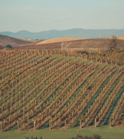
The Yolo County agricultural plain surrounding the Yolo community is among the most productive agricultural land in California, with the deep alluvial soils and reliable irrigation water from the Sacramento River system supporting a diverse range of crops including processing tomatoes, corn, wheat, sunflowers, and alfalfa. The visual character of the valley floor changes dramatically through the agricultural seasons, from the open bare soil of the winter fallow period to the intense green of the spring emergence to the heat-haze gold of the summer harvest and the dusty activity of the fall processing tomato and corn harvest. For buyers who find the working agricultural landscape aesthetically compelling and who appreciate living within a genuine farming economy rather than adjacent to it, the Yolo community area provides an immersive agricultural environment at a price that reflects its limited commercial amenity rather than its agricultural landscape quality.

The Yolo Bypass Wildlife Area, located east of the community toward Sacramento, provides managed wetland habitat for migratory birds and provides exceptional birdwatching access during the fall and winter migration period. The bypass area is one of the Sacramento Valley’s most important wetland habitats and is worth understanding as a seasonal recreation resource for Yolo community residents who are interested in wildlife observation.

Who buys real estate in Yolo?

The buyer who specifically targets the Yolo community area is typically motivated by one of a small number of specific priorities: agricultural land ownership, a very affordable rural homestead within central Yolo County, or the specific appeal of the Sacramento Valley agricultural landscape as a residential setting. The community’s minimal profile in the conventional residential market means that buyers who research the area carefully and approach it with appropriate rural property due diligence will find a genuinely affordable rural residential option in a highly productive agricultural landscape within practical range of Woodland’s commercial infrastructure. TKG recommends that all Yolo community area buyers conduct thorough rural property due diligence including water rights, zoning compliance, access road conditions, and agricultural easement review before making an offer on any rural parcel in this area.

What is Yolo like to live in?

The Yolo community occupies a distinctive position in the Yolo County residential market as the smallest named community in the county and one of the few rural California communities that shares its name with the county in which it is located. The community's minimal commercial infrastructure, consisting primarily of the grain raise and the post office that define its physical presence in the flat agricultural landscape, creates a genuine rural address rather than a community identity in the civic sense. The permanent resident population knows each other by name and by household, and the social connections among Yolo community residents are formed through the shared experience of agricultural life, the Yolo Union Elementary School, and the informal neighbor networks that rural communities of this scale develop organically over generations of shared residence.

The community's geographic centrality in Yolo County provides residents with reasonable access to the county's two main service centers. Woodland to the east and Davis to the southeast are both within approximately 15 to 25 minutes by car via the county road network, and the availability of two distinct commercial and service centers within practical driving distance means that Yolo community residents are not dependent on a single destination for their daily and weekly service needs. Woodland provides the county seat services, the Yolo County government offices, the Woodland Memorial Hospital healthcare access, and the broader commercial retail infrastructure. Davis provides the UC Davis cultural and commercial resources, the specialty food and retail environment of a university town, and the Amtrak station for long-distance rail travel.

Yolo Bypass Wildlife Area

The Yolo Bypass Wildlife Area, managed by the California Department of Fish and Wildlife approximately 10 to 15 miles east of the Yolo community, is one of the Sacramento Valley's most significant managed wetland habitats and provides exceptional wildlife observation access for the Yolo County rural population. The bypass area's seasonal flooding during wet winters creates the temporary wetland habitat that supports hundreds of thousands of migratory waterfowl and shorebirds that use the Sacramento Valley's wetland system during the Pacific Flyway migration. The spectacle of massive flocks of snow geese, northern pintails, and tundra swans using the bypass habitat during peak migration periods in November and December is one of the most impressive wildlife events in California, and the Wildlife Area's viewing platforms and access roads allow observation without significant hiking effort.

The Yolo Basin Foundation's educational programming at the wildlife area includes the Bat Walk events that have become one of the Sacramento region's most popular wildlife observation experiences, drawing several hundred participants on summer evenings to observe the emergence of the Mexican free-tailed bat colony that roosts under the Yolo Causeway bridge. The colony, estimated at 250,000 individuals during peak summer occupancy, is one of the largest urban bat roosts in the western United States and provides a specific wildlife attraction that is unique to the Yolo County area and that has generated significant positive media attention for the wildlife area's mission.

Is rural property in Yolo a good investment?

Agricultural land investment in the Yolo community area reflects the broader Sacramento Valley farmland market dynamics that have been characterized by sustained appreciation as urban capital has sought agricultural land as an inflation hedge and as the productive capacity of the Sacramento Valley's irrigated agricultural land has become increasingly recognized as a long-term value asset. The combination of deep, productive alluvial soils, established water rights within the Yolo County Flood Control and Water Conservation District service area, and the long growing season that supports multiple crop rotations annually has sustained strong institutional and private investor interest in the most productive Sacramento Valley agricultural land.

For buyers who are approaching the Yolo community area from a residential rather than an agricultural investment perspective, the primary attraction is the combination of affordable rural homestead pricing and the central Yolo County geographic position that provides reasonable access to the county's service infrastructure without the lifestyle premium that the Winters, Davis, or West Sacramento markets command. The honest assessment of the Yolo community as a residential choice is that it delivers an authentic Sacramento Valley agricultural residential experience at the most affordable price point available in Yolo County, with all the limitations in service access, commercial amenity, and community infrastructure that this price positioning implies.

Yolo Community in the Sacramento Valley Context

The Yolo community's position in the center of one of California's most productive agricultural regions gives it a contextual significance that exceeds its small physical footprint. The valley floor that surrounds Yolo has been farmed continuously since the mid-19th century, and the accumulated agricultural knowledge, water infrastructure, and farming tradition that characterizes the central Yolo County agricultural plain represents a form of community heritage that is invisible to casual visitors but is deeply felt by the farming families who have worked this land across multiple generations. The Yolo community's grain raise is a working piece of agricultural infrastructure that represents the physical manifestation of this agricultural tradition, receiving and storing the grain harvests that are the economic product of the surrounding farming families' annual labor.

The Yolo Farmershed initiative and the broader Yolo County food systems planning efforts have given the county's agricultural communities, including the Yolo area, a connection to the local food movement that has grown in the Sacramento and Bay Area regions over the past decade. The county's investment in farm-to-fork programming, which takes Sacramento's culinary identity as a platform for connecting urban consumers to the agricultural production of the Sacramento Valley, provides a market development framework that benefits the smaller farms and specialty producers in the Yolo County agricultural landscape.

What are the property taxes in Yolo?

Property taxes in the Yolo unincorporated community area are assessed by Yolo County at the standard California Proposition 13-governed rate of 1 percent of assessed value, with additional special assessments for the Yolo Union Elementary School District parcel tax, the Yolo County Library assessment, and any applicable drainage or reclamation district assessments depending on the specific parcel's location. The total annual property tax obligation for a typical Yolo community area residential property is generally in the range of 1.1 to 1.3 percent of assessed value, inclusive of the school district parcel tax and other special assessments. For agricultural parcels that are enrolled in the Williamson Act land conservation program, the assessed value is based on the agricultural income capacity of the land rather than the market value, which can result in substantially lower property tax obligations than market-value assessment would produce for the same parcel.

Yolo County's rural service delivery to the unincorporated community area includes the Yolo County Sheriff's Office patrol coverage, road maintenance through the Department of Public Works, and county library services through the Yolo County Library system. The county's rural service delivery standard reflects the budget constraints of providing services across a large geographic area with a dispersed population, and response times for non-emergency county services are typically longer than in incorporated city environments. Buyers who are accustomed to the service responsiveness of incorporated city government should calibrate their expectations for county-level unincorporated community service before making a Yolo area rural purchase.

Why do people stay in Yolo?

For buyers who are making a long-term ownership commitment to the Yolo community area, the agricultural land's durable value as a productive asset within one of California's most fertile growing regions provides the foundational investment rationale that exceeds the near-term residential market dynamics. The Sacramento Valley's agricultural land has appreciated meaningfully over the past two decades as the combination of population growth, climate-driven interest in domestic food security, and the recognition of the Sacramento Valley's water rights position within the California water system has attracted institutional and private investment capital to the agricultural land market. Residential land within agricultural zones has participated in this appreciation trajectory while also benefiting from the growing demand for rural lifestyle properties among Bay Area and Sacramento buyers who are seeking alternatives to the urban density and cost of the metropolitan residential markets.

The specific community infrastructure limitations that define the Yolo area, the minimal commercial presence, the rural school district, and the absence of transit access, are features that constrain the demand base for Yolo residential properties to a specific buyer profile rather than eliminating demand entirely. The buyers who acquire Yolo area properties and hold them over a 10-to-20-year horizon typically experience modest but positive appreciation that reflects the agricultural land market's overall trajectory rather than the more dramatic cycles of the metropolitan residential market. The illiquidity of the Yolo rural market means that exit timing matters more than in liquid markets, and sellers who need to transact quickly in the Yolo area may not achieve the pricing that patient sellers who wait for the appropriate buyer can obtain over a longer marketing period.

TKG's overall assessment of the Yolo community area is that it serves a specific and self-selecting buyer profile better than any other Yolo County market serves that same profile, and that buyers who match that profile and approach the area with appropriate expectations will find a genuine and satisfying rural residential experience at the most accessible price point available in the county.

The Yolo community's combination of affordability, central Yolo County position, and authentic Sacramento Valley agricultural character makes it the right choice for a specific buyer profile that values the rural lifestyle and the agricultural land access over the commercial amenity and community infrastructure that the county's incorporated cities provide. For that buyer, Yolo is a genuine and satisfying residential option at the most accessible price point in one of California's most productive agricultural regions.

Browse all Yolo County real estate.
Our extensive guide through the neighborhoods below will help you identify the one for you.

Similarneighborhoods

Luxury home in Clarksburg, CA featuring modern architecture and manicured landscaping

Clarksburg

Elegant luxury home in Dunnigan, CA showcasing sophisticated real estate architecture and design

Dunnigan

Aerial view of Knights Landing, California residential community showcasing luxury homes and waterfront properties

Knights Landing

Luxury home in Madison, California showcasing elegant architecture and premium real estate design

Madison

What is Yolo, California?

Yolo is a small unincorporated farming community in Yolo County, about five miles northwest of Woodland and roughly 24 miles northwest of Sacramento. The U.S. Census Bureau first recognized it as a census-designated place in 2010. It covers about 1.37 square miles, all of it land, at an elevation of 82 feet, and it recorded 425 residents in the 2020 census, down from 450 in 2010.

That scale is the whole story. Yolo is not a subdivision or a master-planned community. It is an old valley settlement surrounded by row-crop and orchard ground, close enough to Woodland for groceries and schools, close enough to Sacramento and Davis for work, and far enough from both that the parcel you buy is likely bordered by farmland rather than another rooftop. That arrangement is rare within 30 miles of a state capital.

Browse the current listings below, or contact The Knight Group and we will tell you what is actually available, what is quietly for sale, and what the land around it is zoned to do.

Where exactly is Yolo, and what surrounds it?

Yolo sits in the Sacramento Valley floor, in the northern half of Yolo County. Its ZIP code is 95697 and its area code is 530. The county seat, Woodland, is the nearest full-service city and the practical hub for anyone living here: Woodland recorded 61,032 residents in the 2020 census and serves as the retail, medical, civic, and school center for this part of the county.

Yolo County covers 1,024 square miles and recorded 216,403 residents in the 2020 census. Four cities are incorporated: Davis, Woodland, West Sacramento, and Winters. Everything else is unincorporated, including Yolo and roughly a dozen other census-designated places such as Esparto, Knights Landing, and Clarksburg. Nearly all of the county’s land area is farm ground, floodplain, and coast-range foothill, not town.

Head west from Woodland along State Route 16 and you enter the Capay Valley, a narrow agricultural corridor running alongside Cache Creek through Madison, Esparto, Brooks, Guinda, and Rumsey. Head east and you drop into the Yolo Bypass and then the Sacramento River. Head north and the valley opens into the rice and tomato ground of the upper county. Yolo sits at the center of that pattern, which is why it reads as agricultural rather than suburban despite being a short drive from two mid-size cities.

Who lives in Yolo, and how has that changed?

The 2020 census counted 425 people in the Yolo CDP, a population density of about 309.5 people per square mile. That is a 5.6 percent decline from the 450 counted in 2010, the first year the place was tracked as a CDP. In a community this size, a drop of 25 people is a handful of households, not a trend, so read the number as stability rather than decline.

The community is predominantly Hispanic or Latino: the 2020 census recorded 302 residents, or 71.1 percent of the population, identifying as Hispanic or Latino of any race. The same count recorded 32.7 percent White and 19.8 percent multiracial.

Practically, this is a working agricultural community with deep multi-generational tenure. Homes here often move within families or between neighbors before they ever reach the open market. If you are buying in Yolo, expect the inventory you can see online to be an incomplete picture of what is actually available.

What kinds of homes come up for sale in Yolo?

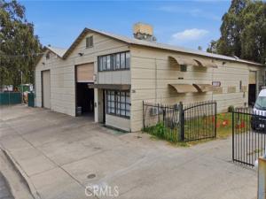
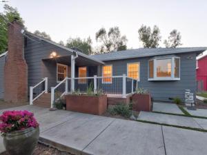
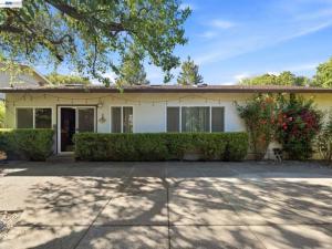
Housing here is older, low-density, and varied. An old valley settlement that never got a tract builder produces a mix: modest early-twentieth-century farmhouses on generous village lots, a scattering of mid-century single-story homes, manufactured homes on permanent foundations, and, outside the CDP boundary, working agricultural parcels with a residence attached.

There is no meaningful condominium or townhome stock and no HOA-governed subdivision. What you are usually buying is a detached house on a parcel large enough that the improvements are only part of the value. On ag parcels outside the community, the land, water rights, irrigation infrastructure, and any planted permanent crop can outweigh the house entirely, and each needs to be valued and inspected as a separate asset.

We are not going to publish a median price for Yolo. With 425 residents across 1.37 square miles, the number of arm’s-length sales in a given year is small enough that a published median is a statistical artifact, not a market signal. One estate sale or one large ag parcel moves it by six figures. Ask us for the actual comparable sales instead.

What does the wider Yolo County market look like?

The county has three distinct markets, and Yolo buyers end up comparing against all of them.

Davis is the university market. The city recorded 66,850 residents in the 2020 census and is built around the University of California, Davis, which enrolled 40,850 students as of 2023 and employs 25,227 people, by far the largest employer in the county. Davis is dense by valley standards, bike-oriented (named the first Platinum-level Bicycle Friendly Community in the United States in 2005), and consistently the most expensive place to buy in Yolo County. Demand there is structural: faculty, staff, medical professionals, and investor-owned student rentals compete for constrained supply.

Woodland is the county seat and the practical center of gravity for northern Yolo County. It incorporated on February 22, 1871, after the previous county seat at Washington, now part of West Sacramento, flooded. Its economy blends agriculture with distribution and manufacturing: Target’s distribution center alone employs 1,325 people. Downtown carries a genuine historic core, including the Woodland Opera House, originally built in 1885 and rebuilt in 1895 and 1896, and a Carnegie-funded library from 1905. Woodland is where most Yolo residents shop, bank, and go to school.

West Sacramento is the port and logistics city on the Sacramento River, across from downtown Sacramento, and its market behaves more like inner-ring Sacramento than like the rest of the county. Countywide economic output reached $18.735 billion in 2022.

Against those three, Yolo trades at a discount for the obvious reasons: fewer services, older housing stock, no city government. Buyers accept that trade for land and quiet.

How does Cache Creek shape this part of the county?

Cache Creek is the reason agriculture works here. The creek begins at the outlet of Clear Lake in Lake County and runs 87 miles east through Lake, Colusa, and Yolo counties before ending in a settling basin east of Woodland. It does not reach the Sacramento River directly under normal conditions; overflow from the settling basin runs to the river through a flood control canal, and during Sacramento River flood events that water routes into the Yolo Bypass instead.

The water that irrigates this part of the valley is diverted at the Capay Diversion Dam and distributed through a canal network of roughly 175 miles managed by the Yolo County Flood Control and Water Conservation District. If you are buying ground with an irrigation entitlement, that district relationship is a material part of the transaction and should be documented before you release contingencies, not after.

Cache Creek also carries hazard history. The 1906 San Francisco earthquake triggered a landslide that temporarily dammed the creek north of Rumsey, and when the blockage failed the released water caused severe downstream flooding. Valley watercourses here are managed, not tame.

What flood risk should a buyer in northern Yolo County check?

Flood engineering is a defining feature of this county, and any buyer should treat it as a due-diligence item rather than a background fact. The Yolo Bypass, southeast of Yolo, is a 59,000-acre engineered floodway running about 41 miles north to south and roughly three miles wide, sitting between Woodland to the north and Rio Vista to the south. Its job is to keep Sacramento dry. When flow in the Sacramento River exceeds approximately 55,000 cubic feet per second, the excess spills over the Fremont Weir, a passive structure about 32 feet tall completed in 1929, and into the Bypass. The combined river-and-bypass system is designed to carry a maximum of 600,000 cubic feet per second.

About 75 percent of the Bypass is privately owned and farmed in most years, growing rice, safflower, processing tomatoes, corn, sunflower, and irrigated pasture. Land inside a floodway is farmland that is expected to go underwater on a schedule set by the weather.

None of that tells you the flood designation of a specific parcel in or near Yolo. It tells you why the question matters here more than in most California markets. Before you write an offer, pull the current FEMA flood map for the exact parcel, confirm the flood insurance requirement your lender will impose, and ask what levee or drainage district the property sits behind.

What should I know about agricultural zoning and Williamson Act contracts?

Much of the land around Yolo is under agricultural zoning, and a substantial share of California farmland is enrolled under the Williamson Act, formally the California Land Conservation Act of 1965. The mechanism is straightforward: an owner enters a ten-year contract with the county restricting the land to agricultural or open-space use, and in exchange the property is assessed on its agricultural income potential rather than its market value, which sharply reduces the property tax bill.

The consequences for a buyer are real. The contract runs with the land, so you inherit it. The tax advantage is meaningful and continues, but so does the use restriction, which limits what you can build and how you can subdivide. If you or a prior owner files for non-renewal, the contract winds down over a period of years and the assessed value steps back toward market value during that wind-down, raising the tax bill along the way. Cancellation outside of non-renewal is difficult and expensive by design.

If a parcel you are considering is enrolled, get the recorded contract, the county’s confirmation of its status, and a tax projection under both contract and non-renewal before you commit. Do not rely on a listing remark. This is where valley buyers get surprised after closing.

What schools serve Yolo?

Yolo is within the Woodland Joint Unified School District, which operates ten elementary schools, two middle schools, and two comprehensive high schools across the district. Cache Creek High School, a continuation high school, operates locally.

Woodland Community College serves the area for two-year and transfer coursework. For four-year education, the University of California, Davis, is the dominant institution in the county, with 40,850 students enrolled as of 2023 and a research profile centered on agricultural, environmental, and veterinary science.

School assignment in unincorporated areas is less obvious than in a city, and boundaries change. Verify the assigned school for the specific address with the district directly rather than relying on a third-party rating site. We will make that call with you.

How is the commute from Yolo?

Woodland is the gateway. From Yolo, essentially every trip starts by driving into or past Woodland, which is where the region’s highway connections converge. Interstate 5 curves through the city, State Route 113 enters from the south as a controlled-access freeway toward Davis, and State Route 16 provides the western route through Esparto and up the Capay Valley.

Sacramento is about 24 miles southeast of Yolo, which makes state government, downtown professional work, and the region’s major hospitals a routine daily commute. Davis sits about 11 miles west of Sacramento and is reachable from Woodland via State Route 113. Davis also has an Amtrak Capitol Corridor station, the practical rail option toward Sacramento and the Bay Area.

The Bay Area is a different proposition. Interstate 80 through Davis and Vacaville is the route, and it is long in normal traffic and punishing at peak. Buyers relocating from the Bay Area on a hybrid schedule usually make this work at two or three office days a week. Five days is a hard life.

What is there to do near Yolo?

The recreation here is outdoor, agricultural, and regional rather than local. Cache Creek supports kayaking, rafting, canoeing, and tubing in the dry season, largely on agricultural water releases from upstream storage. The Yolo Bypass Wildlife Area is one of the more significant birding destinations in the Central Valley, with more than 280 terrestrial vertebrate species recorded.

The Capay Valley, west along State Route 16, is the county’s agritourism corridor: small farms, olive oil and nut producers, and seasonal farm events strung along the creek through Madison, Esparto, Brooks, Guinda, and Rumsey. Cache Creek Casino Resort in Brooks, owned and operated by the Yocha Dehe Wintun Nation, is the largest single destination in that corridor. It began as a bingo hall on June 25, 1985, opened as a full resort in 2004, and added 459 hotel rooms in a 2017 expansion. It now runs 659 rooms, about 74,270 square feet of gaming space, eleven restaurants, and an 18-hole championship golf course.

Downtown Woodland supplies the everyday version: restaurants, a restored Victorian core, the Woodland Opera House, and a multiplex. Sacramento is half an hour away, and Napa and the Sierra foothills are each within a weekend radius.

What are the honest trade-offs of buying in a community this small?

Start with the ones that cost money. Thin comparable sales make appraisal risk real, and a low appraisal on a rural property is a common reason deals renegotiate or fall apart. Financing can be harder: lenders treat significant acreage, agricultural income, and unusual outbuildings differently than a tract house, and some loan products simply do not apply. Insurance underwriting in the valley increasingly asks pointed questions about flood exposure and distance to a staffed fire station.

Then the ones that cost convenience. There is no city government and no city services here, so you deal with county departments for permits, code questions, and road maintenance. Utility, water, and wastewater arrangements vary parcel to parcel in unincorporated valley communities. Confirm in writing whether a property is on a community system, a private well, a septic system, or some combination, and get the well and septic inspected. Verify broadband at the address before you assume you can work from home.

And the one that is simply the nature of the place. You are buying next to working agriculture: equipment noise at odd hours, dust during harvest, aerial and ground application of crop inputs, irrigation schedules, seasonal odors. California’s right-to-farm framework generally protects established agricultural operations from nuisance complaints by newer neighbors. Better to learn now than after closing.

The offsetting case is straightforward: land, sky, quiet, and a working agricultural setting inside half an hour of the state capital, at a basis you cannot replicate in Davis or the Sacramento suburbs.

Frequently asked questions about buying in Yolo, California

Is Yolo a city?

No. Yolo is an unincorporated community and a census-designated place in Yolo County. It has no city government. County government in Woodland handles planning, permits, and services, and the CDP boundary exists for census purposes rather than as a jurisdictional line.

How many people live in Yolo?

The 2020 census counted 425 residents across about 1.37 square miles, down from 450 in the 2010 census, when the community was first designated as a CDP.

What is the ZIP code for Yolo, California?

95697. The area code is 530.

Why is it called Yolo?

The community has carried several names over its history. It has been known as Cacheville, Cochran’s Crossing, Cochranes Crossing, Hutton’s Ranch, and Travelers Home before settling on Yolo, which is also the county name.

What school district serves Yolo?

Woodland Joint Unified School District. Cache Creek High School, a continuation high school, operates in the community. Always confirm the assigned school for a specific address with the district, since boundaries in unincorporated areas change.

Is flood insurance required in Yolo?

It depends entirely on the parcel’s FEMA flood zone designation and your lender’s requirements, and this county has significant engineered flood infrastructure including the 59,000-acre Yolo Bypass to the southeast. Pull the current flood map for the exact address before you write an offer. We handle this as a standard step.

Can I build a second home or subdivide agricultural land near Yolo?

Often not, or not easily. Agricultural zoning limits density, and any parcel under a Williamson Act contract is contractually restricted to agricultural or open-space use for a rolling ten-year term in exchange for reduced property tax assessment. Verify zoning, contract status, and county policy in writing before you buy on the assumption that you can build.

How far is Yolo from Sacramento and Davis?

Yolo is about 24 miles northwest of Sacramento and about five miles northwest of Woodland. Davis sits about 11 miles west of Sacramento and is reached from Woodland via State Route 113. Davis also offers Amtrak Capitol Corridor service toward Sacramento and the Bay Area.

How does The Knight Group work in Yolo County?

We work this market by verification, not by listing feed. In a community of 425 people, the public inventory is a fraction of what is actually in play, so the first job is finding out what exists: who is thinking about selling, which parcels are held in family trusts, and what has traded privately in the last several years. That is a phone-and-relationship exercise, not a search filter.

The second job is diligence, and rural Yolo County has a specific list. FEMA flood zone and levee district. Water source: community system, private well with a documented yield, or a district irrigation entitlement tied to the Yolo County Flood Control and Water Conservation District canal network. Septic condition and permit history. Zoning and any recorded Williamson Act contract. Easements, access, and utility service to the parcel line. Any of these can move value by a wide margin, and none are reliably disclosed in a listing.

The third job is pricing. We build valuations from actual comparable transactions with the property characteristics attached, and we will tell you when the data is too thin to support a confident number, because here it sometimes is. You get the range and the reasoning, not a single figure with false precision.

If you are considering a purchase in or around Yolo, or you own here and want an honest read on what your property would bring, contact The Knight Group. Bring the parcel number and we will start with the record.

Work With Us

The Knight Group is here to help you with all your realty needs. To get started, fill out the form below and one of our experienced agents will contact you as quickly as possible.

The Knight Group Logo

The Knight Group

8560 W Sunset Blvd., Floor 3
West Hollywood, CA 90069
503-200-4823
[email protected]

Copyright © 2024 The Knight Group. 
All rights reserved.  License: 02133297

Hey, You ALMOST MISSED IT!

Lucky for you we’re looking out.

Subscribe to this Custom Search to be alerted when new properties hit the market in the area.

Choose the frequency that works for you.

get alerts

[showcaseidx_contact]